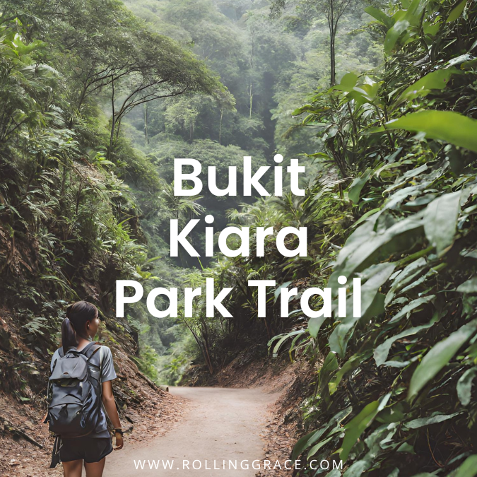
The Bukit Kiara trail is one of the most accessible hiking options in Kuala Lumpur, running through a forested hill on the edge of Taman Tun Dr Ismail. The park draws joggers, mountain bikers and hikers through the week, with the crowd building considerably on weekend mornings when the car park along Jalan Aminuddin Baki fills before 7am.
The terrain is manageable for most fitness levels. The main loop runs four kilometres and takes roughly two hours at a comfortable pace. What makes the Bukit Kiara trail worth the detour is the density of the forest relative to how close it is to the city centre. You can be on a dirt path within minutes of leaving the main road in TTDI.
Read also: Top Putrajaya Parks: 8 Best Spots for Hiking & Walking
Bukit Kiara Trail Distance and Difficulty
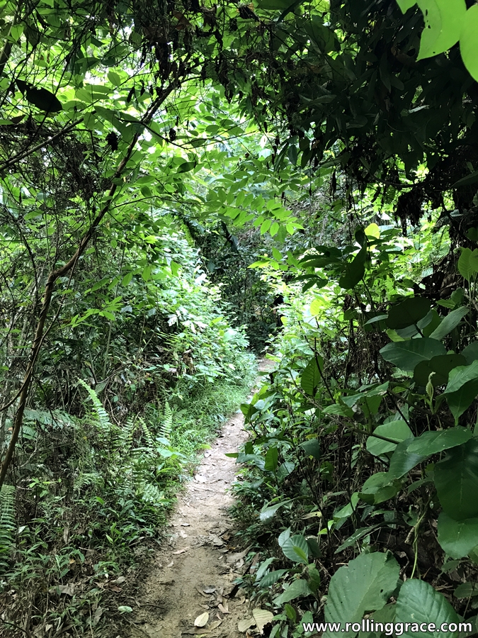
The park holds a network of paths across the hill, ranging from a flat loop around the lake at the base to steeper routes climbing toward the upper ridge. The lower trails are well-worn and easy to follow. Higher up, the paths narrow and the markings become inconsistent, with several forks that can redirect you toward Sri Hartamas or Mont Kiara if you lose track of the route.
For first-time visitors, following the main trail along the ridge line is the most straightforward approach. The canopy provides enough shade to keep the heat manageable during morning hours and the views open up at the higher points along the route.
- Difficulty: Easy
- Distance: 4 kilometres
- Duration: 2 hours
- Entrance fee: Free

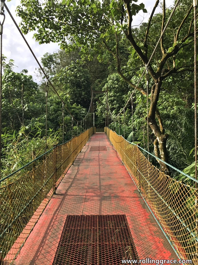
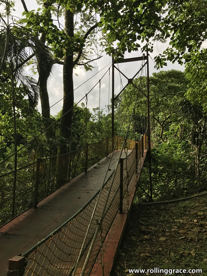
Bukit Kiara Suspension Bridge
The suspension bridge forms part of the jogging track that circles the park, connecting sections of the Bukit Kiara trail that would otherwise require backtracking.
It is a functional structure rather than a feature attraction, but it offers a clear view over the tree canopy from the midpoint of the crossing and serves as a useful landmark on the main loop.
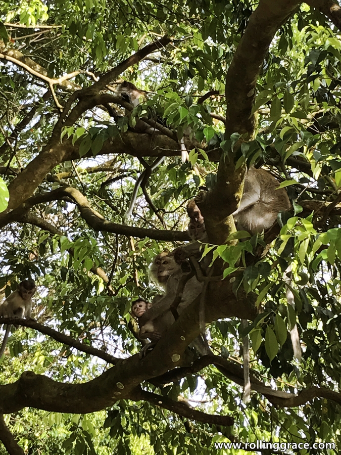
Wildlife on the Trail
Monkeys are common throughout the park and move freely across the Bukit Kiara trail, particularly in the upper sections. They are generally indifferent to hikers but will approach if you are carrying visible food. Keep bags closed and do not feed them under any circumstances.
Mosquitoes are present throughout, more so in the lower sections near the lake. Apply an eco-friendly repellent before you start. The trail surface is uneven in places and proper footwear makes a noticeable difference, particularly after rain when the dirt paths become slippery.
History of Bukit Kiara
The land that makes up Bukit Kiara was historically a rubber estate. As Kuala Lumpur expanded through the latter half of the twentieth century, the area transitioned from agricultural use into a public green space serving the surrounding residential neighbourhoods of TTDI, Mont Kiara and Sri Hartamas.
The rubber trees that remain along sections of the lower trail are a visible trace of that earlier use. The park is now managed as one of KL’s designated green lungs, sitting within one of the city’s most densely populated residential corridors.
What to Bring
- Mosquito repellent, ideally biodegradable
- At least one litre of water per person
- Proper trail shoes with grip
- A stick may be useful if you are heading into the upper sections where monkey encounters are more frequent. Our advice, though, is simply not to disturb them. It is their home after all, and we are the visitors.
Hiking Tips for Bukit Kiara
Start before 8am. The Bukit Kiara trail is cooler, less crowded and easier to navigate in the early morning hours. Avoid starting after 5pm as darkness falls around 7:30pm and the upper sections of the trail are unlit.
Trail markings are inconsistent beyond the lower loop. Check Google Maps before heading out and note that several paths connect through to Sri Hartamas and Mont Kiara, which can add significant distance to your route if you take a wrong turn at one of the upper forks.
There is no official trail map available online. The AllTrails listing for Bukit Kiara gives a reasonable overview of the main route and is worth downloading before you arrive.

How to Get to Bukit Kiara Trail
The main trailhead for the Bukit Kiara trail is at TTDI Park, next to the primary school on Jalan Aminuddin Baki. A line of parked cars along the road is the clearest indicator that you are in the right place. The open car park at the park entrance is the standard starting point for most visitors.
By public transport, take the Kajang MRT line to TTDI station and walk toward the park. The walk from the station to the trailhead takes around ten minutes on foot.
By car, set your GPS to TTDI Park or Taman Rimba Kiara. Roadside parking is available along Jalan Aminuddin Baki but fills quickly on weekend mornings.
Best Time to Visit Bukit Kiara
Early morning between 6am and 9am gives you the coolest temperatures, the most active wildlife and the best light through the canopy. Late afternoon is a workable alternative but factor in the 7:30pm sunset and plan your descent accordingly.
The Bukit Kiara trail is open year-round. The paths remain hikeable through most of the wet season though the upper sections get significantly muddier after sustained rain. If it has rained heavily the night before, stick to the lower loop around the lake rather than attempting the upper ridge routes.
Sustainability
Bukit Kiara is a designated urban forest reserve within Kuala Lumpur. Visitors are expected to carry out all waste, stay on marked trails and avoid disturbing the wildlife.
The use of biodegradable mosquito repellent helps protect the waterways running through the lower sections of the park. The long-term health of the trail depends on the habits of the people who use it regularly.
Love stories like this? Subscribe to the Rolling Grace newsletter for thoughtful travel notes, hidden dining gems, and slow discoveries from across Asia.
Leave a Reply